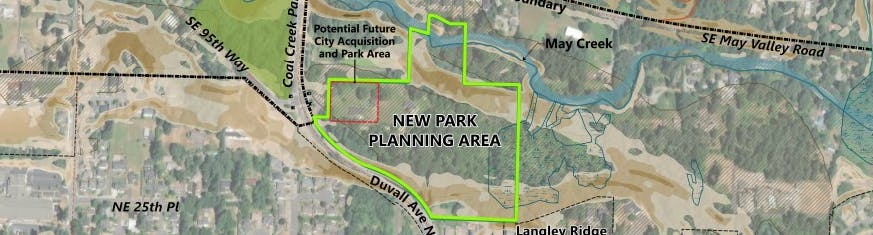
New Park Location and Planning Area
The planning area for the new park spans approximately 18.5 acres within Renton's East Plateau neighborhood near the boundary with the City of Newcastle and unincorporated King County. Over the past 30 years, the City has gradually acquired land with the intention of using it as parkland. The park planning area is bordered by May Creek to the north, Duvall Avenue NE to the west, and residential neighborhoods to the south. The future park is also adjacent to a City-owned Surface Water Utility Facility to its northwest.

Vicinity Map
Share New Park Location and Planning Area on Facebook
Share New Park Location and Planning Area on Twitter
Share New Park Location and Planning Area on Linkedin
Email New Park Location and Planning Area link

Thank you for your contribution!
Help us reach out to more people in the community
Share this with family and friends